By Joseph Delesantro
Joseph Delesantro is a Ph.D. student in ecology at UNC-Chapel Hill.
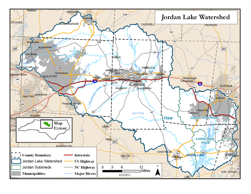
The Jordan Lake Reservoir was completed in the early 1980s to prevent flooding and allow for greater growth and economic opportunities in the region. Today the lake is used by over 700,000 water customers and the Jordan Lake watershed, from Greensboro to Durham, is experiencing incredible growth and the opportunity.
However, runoff, sewage and waste water effluent from our growing communities contains pollutants that threaten the very lake that has helped sustain this growth. Nutrients from our communities, our lawns, sewage and roads, are making their way to Jordan Lake and feeding algal blooms that may kill fish, make the water unsuitable for recreation and greatly increase the cost of treatment for drinking water. By managing this nutrient pollution and protecting our vital drinking water sources, we can also help to sustain prosperous growth in central North Carolina.
The Jordan Lake watershed is large and diverse, spanning from rural to urban. Across these land uses nutrient sources vary greatly (e.g. agriculture runoff, septic systems, leaking sewers), as does the movement of water transporting these nutrients which is altered by roads, parking lots, roof gutters, ditches and storm water pipes.
We are working in conjunction with dozens of other researchers on the UNC Jordan Lake Study as part of a multi-year study mandated by the North Carolina General Assembly and funded by the North Carolina Policy Collaboratory.
In order to inform targeted and efficient management of nutrients across the watershed, our research team is asking four questions as part of our work:
- “What are the major sources of nutrients?”, so that we can limit these sources.
- “Where are they coming from on the landscape?”, so that we can target our management strategies.
- “How are they moving from the landscape to waterbodies?”, so that we can intercept these nutrients and limit their mobility.
- “When, under what conditions, are nutrients moving into waterbodies?”, in order to inform the types of management we might use to intercept nutrients.
To answer these questions, we’re focusing on small watersheds with single land uses. This allows us to separate potential sources and development practices that might affect nutrient pollution, to isolate variables. After extensive mapping of infrastructure and land use with the help of local counties, municipalities and satellite imagery, we selected 21 small streams that flow through rural and urban neighborhoods, city parks and across cities in Alamance, Chatham, Durham and Orange counties.
This mapping and sampling provides good spatial resolution, spanning a wide range in land uses and building practices, that allows us to identify the major sources of nutrients and where they’re coming from.
Our team of faculty members, graduate students, and undergraduates at Carolina are out in the field to measure water chemistry and nutrient pollution and record flow every two weeks.
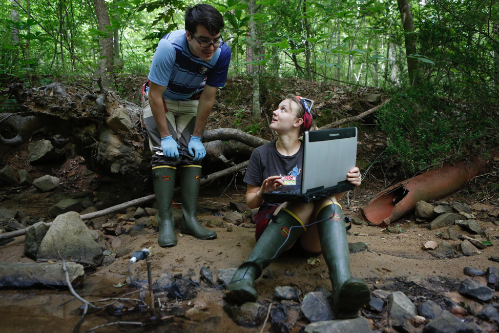
At five of these watersheds we use the latest technology to continuously monitor nutrients, flow and several other parameters. Through automated sensors we collect high temporal resolution (e.g., every 5 minutes) measurements and identify patterns in nutrient loading and associated chemistry across seasonal conditions and throughout storms. These patterns inform our understanding of how nutrients are transported across the landscapes and the conditions that facilitate their movement.
With this combination of mapping, field sampling, and sensors we are working to understand our developed landscapes, rural to urban, as integrated human-natural systems. This understanding will help inform future low impact development as well as the targeted retrofit and management of our existing communities.
Working with the UNC Jordan Lake Study, we’ll provide recommendations for the protection of the water sources that sustain central North Carolina. Next time you go on an evening walk, take another look at your neighborhood’s small streams. In them travels the footprint of your community to lakes and rivers, connecting you to waterbodies, ecosystems and other communities, miles away.
For more information about all of the research being conducted as part of the UNC Jordan Lake Study please visit: https://ie.unc.edu/nutrient-study/symposium/