 Grant Parkins is the Watershed Education Coordinator with the UNC Institute for the Environment.
The UNC Environmental Resource Program (ERP) has teamed up with a UNC researcher on a NASA-funded project designed to better understand how the volume of water in Eastern North Carolina’s lakes is changing.
ERP staff member Sarah Yelton and myself are working with Tamlin Pavelsky, an associate professor of geological sciences at UNC, on the “Lake Level Monitoring Project.” The project is focused in eastern North Carolina, specifically studying eleven lakes clustered in three areas:
- Hyde and Washington Counties in northeastern North Carolina;
- the Croatan National Forest; and
- Bladen and Columbus Counties in the southeastern part of the state.
As part of the project ERP is partnering with state parks, national wildlife refuges, Croatan National Forest, and private landowners to place lake gauges in each of the lakes. A lake gauge is a simple ruler-type tool that is installed in the lake on a dock or free standing post, where lake height measurements can be made.
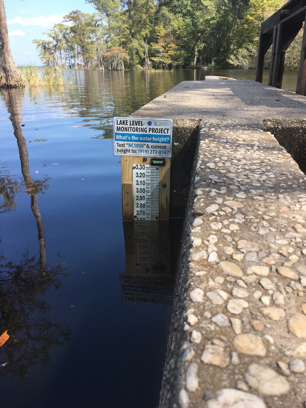
Lake gauge at Lake Waccamaw. Photo courtesy of Stephanie Perret Garret
ERP has also worked to recruit and train citizen scientists to report lake heights. Since the first gauges were installed in April 2017, more than 50 citizen scientists have contributed 322 (and counting) lake height measurements. Measurements have been reported by state park and wildlife refuge staff, trained volunteers, and folks who happen upon the gauge and send a text message with the measurement to a phone number posted nearby.
In addition to monitoring how the lake height is changing in these lakes, Dr. Pavelsky is measuring the surface area of the lakes using photographs taken by the Landsat 8 satellite. If you know how the surface area of a lake has changed, and you know how the lake height has changed, then a bit of algebra can tell you how the volume of water has changed.
One of the lakes we are studying, Jones Lake in Bladen County, provides an example of how this is done. The Landsat 8 satellite passed over Jones Lake, and was able to capture photographs on July 21 and August 22, 2017. Citizen scientists and park rangers at Jones Lake State Park were able to report lake heights on those days as well. The table below shows our surface area and lake height measurements on those days:
Jones Lake
| July 21, 2017 | August 22, 2017 | Change | |
| Lake Height | 1.18 Feet | 1.07 Feet | – 0.11 Feet |
| Surface Area | 209.6 Acres | 206.5 Acres | – 3.1 Acres |
You can see that, in those 32 days, the lake level fell 0.11 feet, or 1.32 inches. That doesn’t seem like a large drop. But we also see that the lake’s surface shrunk by 3.1 acres, which seems more significant. In this case, we found out that on August 22, Jones Lake had about 7.5 million gallons of water less than it had on July 21.
To put it into perspective, that amount of water could fill more than eleven Olympic-sized swimming pools. So although a drop in lake height of just 1.32 inches may not seem like a lot, it actually represents an enormous amount of water lost from Jones Lake.
The team is working to calculate similar changes in water volume in all eleven study lakes, and has plans to study up to four additional lakes by the end of the year. More information about the project, including every measurement submitted by citizen scientists, can be found on the project website: www.lakelevel.org
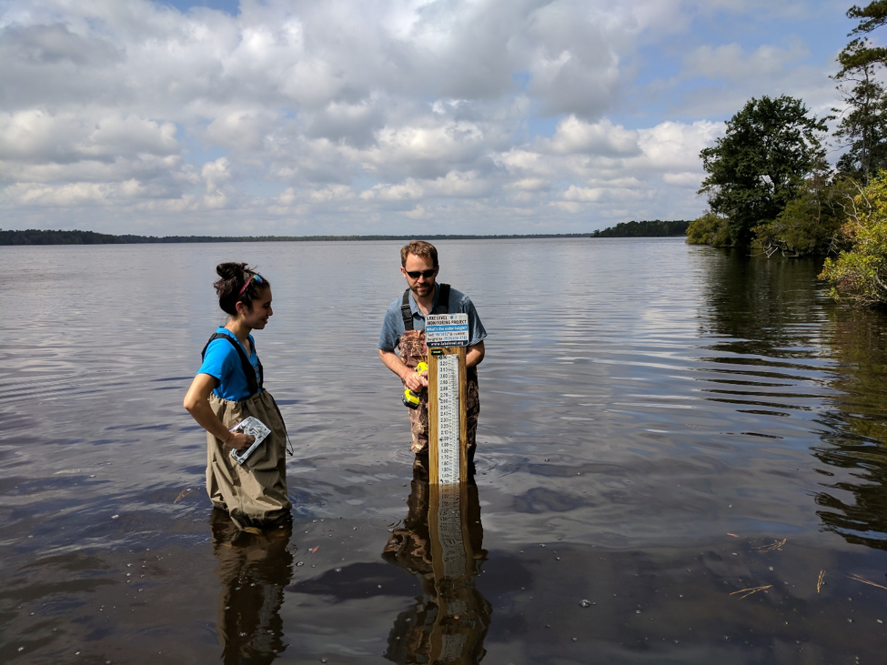 Researchers install lake gauge at Catfish Lake in Croatan National Forest